Geolocate

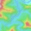
Diffun topographic map

Click on the map to display elevation.

About this map

Name: Diffun topographic map, elevation, terrain.

Location: Diffun, Quirino, Cagayan Valley, Philippines (16.55353 121.46242 16.63353 121.54242)

Average elevation: 156 m

Minimum elevation: 94 m

Maximum elevation: 523 m

Other topographic maps

Click on a map to view its topography, its elevation and its terrain.
Cagayan River

Philippines > Quirino

Average elevation: 443 m

Maddela

Philippines > Quirino

Average elevation: 446 m

Addalam River

Philippines > Quirino

Average elevation: 456 m

Saguday

Philippines > Quirino

Average elevation: 112 m

Aglipay

Philippines > Quirino

Average elevation: 185 m

Cabarroguis

Philippines > Quirino

Average elevation: 296 m

Nagtipunan

Philippines > Quirino

Average elevation: 547 m

Diffun

Philippines > Quirino

Average elevation: 252 m

Maddela

Philippines > Quirino

Average elevation: 446 m

Gear up for your next adventure:

🥘Camping Cookware Set - Compact nesting pots and pans for trail cooking
🪑Insulated Seat Pad - Protect your seat from cold rocks and wet logs
🥾Mountaineering Boots - Supportive boots for climbing and high-altitude hiking
🧥Insulated Jacket - Keep warm in cold outdoor conditions
🧴Insect Repellent - Protect yourself from bugs during outdoor adventures

As an Amazon Associate, this site earns from qualifying purchases at no extra cost to you.