Geolocate

Hisar topographic map

Click on the map to display elevation.

About this map

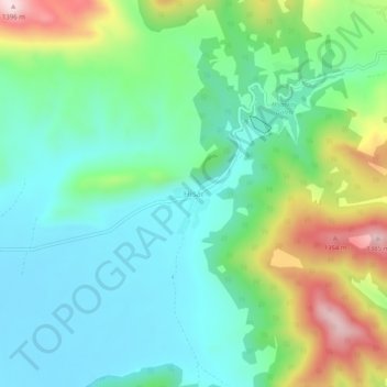
Name: Hisar topographic map, elevation, terrain.

Location: Hisar, Ağlasun, Burdur, Mediterranean Region, Turkey (37.56522 30.61538 37.60522 30.65538)

Average elevation: 1,136 m

Minimum elevation: 1,025 m

Maximum elevation: 1,404 m

Gear up for your next adventure:

🥾Waterproof Hiking Boots - Boots keeping your feet dry in wet conditions
🥾Approach Boots - Comfortable boots for hiking and climbing approaches
💧Filtered Water Bottle - Safe drinking water on the go
🗺️Topographic Maps - Detailed maps to explore trails, mountains, and wilderness areas
🥾Durable Hiking Shoes - Long-lasting shoes for frequent hiking

As an Amazon Associate, this site earns from qualifying purchases at no extra cost to you.