
Make a donation
Gear up for your next adventure:
As an Amazon Associate, this site earns from qualifying purchases at no extra cost to you.
Mattawa topographic map
Click on the map to display elevation.
Make a donation
Gear up for your next adventure:
As an Amazon Associate, this site earns from qualifying purchases at no extra cost to you.
About this map
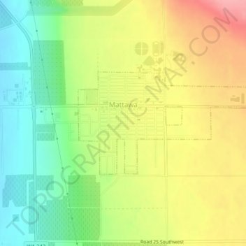
Name: Mattawa topographic map, elevation, terrain.
Location: Mattawa, Grant County, Washington, United States (46.73023 -119.91006 46.74150 -119.87474)
Average elevation: 223 m
Minimum elevation: 173 m
Maximum elevation: 279 m
Make a donation
Gear up for your next adventure:
As an Amazon Associate, this site earns from qualifying purchases at no extra cost to you.
Other topographic maps
Click on a map to view its topography, its elevation and its terrain.
Make a donation
Gear up for your next adventure:
As an Amazon Associate, this site earns from qualifying purchases at no extra cost to you.
Moses Lake
United States > Washington > Grant County > Moses Lake > Moses Lake
Average elevation: 342 m