Geolocate

Bahren topographic map

Click on the map to display elevation.

About this map

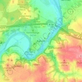
Name: Bahren topographic map, elevation, terrain.

Location: Bahren, Grimma, Landkreis Leipzig, Sachsen, 04668, Deutschland (51.23088 12.74941 51.27088 12.78941)

Average elevation: 161 m

Minimum elevation: 117 m

Maximum elevation: 216 m

Other topographic maps

Click on a map to view its topography, its elevation and its terrain.

Höfgen

Deutschland > Sachsen > Landkreis Leipzig > Grimma

Average elevation: 167 m

Gear up for your next adventure:

🔦LED Headlamp - Hands-free lighting for early morning starts or late finishes
🧭GPS Handheld Device - Reliable GPS navigation for outdoor adventures
🔦LED Headtorch - Bright and durable light for night activities
🧥Insulated Jacket - Keep warm in cold outdoor conditions
🧴Sunscreen SPF - Broad-spectrum sunscreen for outdoor activities

As an Amazon Associate, this site earns from qualifying purchases at no extra cost to you.