Geolocate

Tambillo topographic map

Click on the map to display elevation.

About this map

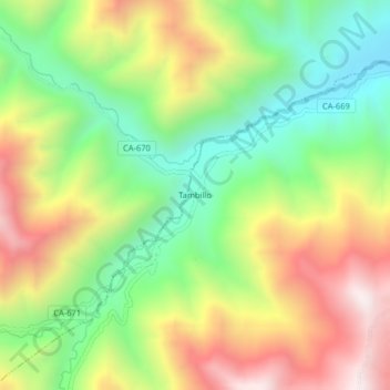
Name: Tambillo topographic map, elevation, terrain.

Location: Tambillo, Colasay, Jaén, Cajamarca, Perú (-5.87565 -79.07295 -5.83565 -79.03295)

Average elevation: 1,491 m

Minimum elevation: 1,063 m

Maximum elevation: 2,035 m

Other topographic maps

Click on a map to view its topography, its elevation and its terrain.

Río Huancabamba

Perú > Cajamarca > Colasay

Average elevation: 934 m

Gear up for your next adventure:

🔥Camping Stove - Portable stoves to cook outdoors with ease
🧊Portable Cooler - Keep food and drinks cold during outdoor adventures
🧥Waterproof Jacket - Lightweight rain jackets for hiking and outdoor activities
🧴First Aid Kit - Essential first aid supplies for outdoor emergencies
🎒Hiking Daypack - Lightweight and durable backpacks for day trips and excursions

As an Amazon Associate, this site earns from qualifying purchases at no extra cost to you.