
Thank you for supporting this site ❤️
Make a donation
Make a donation
Gear up for your next adventure:
As an Amazon Associate, this site earns from qualifying purchases at no extra cost to you.
Maletsunyane topographic map
Click on the map to display elevation.
Thank you for supporting this site ❤️
Make a donation
Make a donation
Gear up for your next adventure:
As an Amazon Associate, this site earns from qualifying purchases at no extra cost to you.
About this map
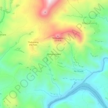
Name: Maletsunyane topographic map, elevation, terrain.
Location: Maletsunyane, Mohale's Hoek District, Lesotho (-30.07290 27.95443 -30.03290 27.99443)
Average elevation: 1,703 m
Minimum elevation: 1,475 m
Maximum elevation: 2,121 m
Thank you for supporting this site ❤️
Make a donation
Make a donation
Gear up for your next adventure:
As an Amazon Associate, this site earns from qualifying purchases at no extra cost to you.