Geolocate

Saint-Daniel topographic map

Click on the map to display elevation.

About this map

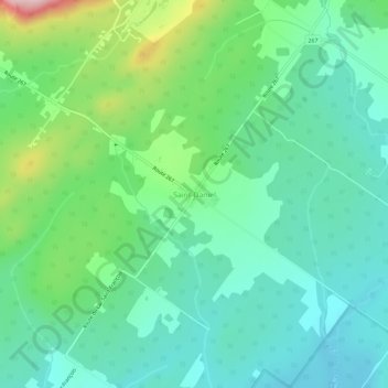
Name: Saint-Daniel topographic map, elevation, terrain.

Location: Saint-Daniel, Adstock, Les Appalaches, Chaudière-Appalaches, Quebec, Canada (45.98755 -71.20246 46.02755 -71.16246)

Average elevation: 361 m

Minimum elevation: 290 m

Maximum elevation: 559 m

Les Appalaches trails, hiking, mountain biking, running and outdoor activities

Gear up for your next adventure:

🏃Hydration Running Vest - Carry water and maps close to your body for speed
🧥Waterproof Pants - Keep dry during rainy hiking conditions
🦯Trekking Poles - Reduced impact on joints for steep topographic climbs
🔦LED Headtorch - Bright and durable light for night activities
🥾Approach Boots - Comfortable boots for hiking and climbing approaches

As an Amazon Associate, this site earns from qualifying purchases at no extra cost to you.