Geolocate

El Hato topographic map

Click on the map to display elevation.

About this map

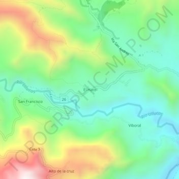
Name: El Hato topographic map, elevation, terrain.

Location: El Hato, Inzá, Oriente, Cauca, Pacífica, Colombia (2.53605 -76.05885 2.57605 -76.01885)

Average elevation: 1,638 m

Minimum elevation: 1,312 m

Maximum elevation: 2,269 m

Gear up for your next adventure:

💧Hydration Bladder - Hands-free hydration solution for long treks
🧢Sun Protection Cap - Breathable cap to protect from sun exposure
🛶Kayak Dry Bag - Waterproof storage for kayaking adventures
🛶Kayak Accessories - Essential gear for safe and fun kayaking adventures
🥾Durable Hiking Shoes - Long-lasting shoes for frequent hiking

As an Amazon Associate, this site earns from qualifying purchases at no extra cost to you.