
Make a donation
Gear up for your next adventure:
As an Amazon Associate, this site earns from qualifying purchases at no extra cost to you.
Maria-Assumpta topographic map
Click on the map to display elevation.
Make a donation
Gear up for your next adventure:
As an Amazon Associate, this site earns from qualifying purchases at no extra cost to you.
About this map
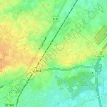
Name: Maria-Assumpta topographic map, elevation, terrain.
Location: Maria-Assumpta, Torhout, Brugge, West-Vlaanderen, 8820, België (51.06399 3.10770 51.10399 3.14770)
Average elevation: 25 m
Minimum elevation: 11 m
Maximum elevation: 40 m
Make a donation
Gear up for your next adventure:
As an Amazon Associate, this site earns from qualifying purchases at no extra cost to you.
Other topographic maps
Click on a map to view its topography, its elevation and its terrain.
Torhout
België > West-Vlaanderen > Brugge > Torhout
Torhout ligt in Zandig Vlaanderen op het Plateau van Wijnendale. De hoogte varieert van 9 tot 44 meter. De bovenloop van de Handzamevaart in het zuidwesten, en het dal van de Velddambeek in het noordoosten, vormen de laagste gedeelten. In het noorden en oosten lagen woeste gronden (veld genaamd). In de 18e…
Average elevation: 22 m
Wijnendale
België > West-Vlaanderen > Brugge > Torhout
Wijnendale ligt op het Plateau van Wijnendale, een plateau in landschap op ongeveer 40 meter hoogte, 20 meter hoger dan het lagere omliggende land.
Average elevation: 35 m