Geolocate

Goochland topographic map

Click on the map to display elevation.

About this map

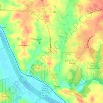
Name: Goochland topographic map, elevation, terrain.

Location: Goochland, Goochland County, Virginia, 23014, United States (37.66244 -77.90493 37.70244 -77.86493)

Average elevation: 74 m

Minimum elevation: 44 m

Maximum elevation: 102 m

Gear up for your next adventure:

🧢Hiking Hat - Sun-protective and breathable hats for long treks
🥾Waterproof Hiking Boots - Essential footwear for rugged terrain and wet Canadian trails
🥾Hiking Leggings - Comfortable leggings for outdoor activities
🧥Packable Rain Jacket - Breathable waterproof layer for unpredictable weather
👟Sport Hiking Sandals - Breathable footwear for water crossings and camp rest

As an Amazon Associate, this site earns from qualifying purchases at no extra cost to you.