
Thank you for supporting this site ❤️
Make a donation
Make a donation
Gear up for your next adventure:
As an Amazon Associate, this site earns from qualifying purchases at no extra cost to you.
Cavaria topographic map
Click on the map to display elevation.
Thank you for supporting this site ❤️
Make a donation
Make a donation
Gear up for your next adventure:
As an Amazon Associate, this site earns from qualifying purchases at no extra cost to you.
About this map
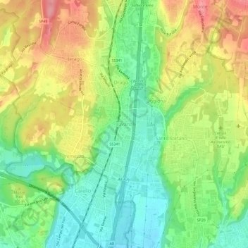
Name: Cavaria topographic map, elevation, terrain.
Location: Cavaria, Cavaria con Premezzo, Varese, Lombardia, 21044, Italia (45.67676 8.78468 45.71676 8.82468)
Average elevation: 294 m
Minimum elevation: 249 m
Maximum elevation: 351 m
Thank you for supporting this site ❤️
Make a donation
Make a donation
Gear up for your next adventure:
As an Amazon Associate, this site earns from qualifying purchases at no extra cost to you.