Geolocate

Cornelius topographic map

Click on the map to display elevation.

About this map

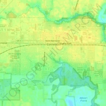
Name: Cornelius topographic map, elevation, terrain.

Location: Cornelius, Washington County, Oregon, United States (45.50638 -123.07077 45.52841 -123.02223)

Average elevation: 51 m

Minimum elevation: 37 m

Maximum elevation: 59 m

Gear up for your next adventure:

🥾Light Hiking Boots - Lightweight and comfortable boots for day hikes
🧥Ultralight Puffy Jacket - Maximum warmth that packs down to the size of an orange
🛶Waterproof Dry Bags - Keep electronics and clothes dry during river crossings
🍽️Titanium Camping Spork - Ultralight and indestructible eating utensil
🧼Biodegradable Camp Soap - Environmentally friendly cleaning for gear and body

As an Amazon Associate, this site earns from qualifying purchases at no extra cost to you.