

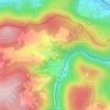
Ebene topographic map
Click on the map to display elevation.
Ebene
Das Dorf liegt in Hanglage an einer überwiegend bewaldeten Anhöhe, die zum Frankenwald zählt. Eine Gemeindeverbindungsstraße verläuft nach Lauenstein (0,6 km südöstlich) bzw. zunächst in Richtung Westen und führt in einem großen Bogen wieder in das nördliche Siedlungsgebiet von Lauenstein zurück.
About this map

Name: Ebene topographic map, elevation, terrain.
Average elevation: 538 m
Minimum elevation: 344 m
Maximum elevation: 717 m
Other topographic maps
Click on a map to view its topography, its elevation and its terrain.
Burg Lauenstein
Deutschland > Bayern > Landkreis Kronach > Ludwigsstadt > Lauenstein
Die Burg Lauenstein ist eine mittelalterliche Höhenburg auf 550 m ü. NN über der oberfränkischen Ortschaft Lauenstein, einem Gemeindeteil der südöstlich davon gelegenen Stadt Ludwigsstadt. Mit ihrer Lage im Norden des Landkreises Kronach ist die Burg, deren älteste Teile auf das 12. Jahrhundert datiert…
Average elevation: 538 m