Geolocate

Portbou topographic map

Click on the map to display elevation.

About this map

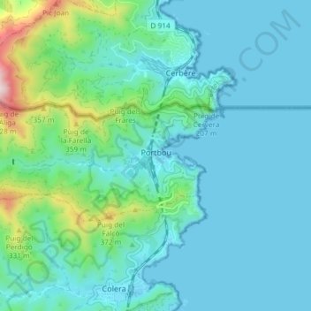
Name: Portbou topographic map, elevation, terrain.

Location: Portbou, Upper Empordà, Girona, Catalonia, 17497, Spain (42.41544 3.10155 42.43819 3.17499)

Average elevation: 97 m

Minimum elevation: -1 m

Maximum elevation: 604 m

Other topographic maps

Click on a map to view its topography, its elevation and its terrain.

Montgó

Spain > Catalonia > Upper Empordà > l'Escala

Average elevation: 17 m

Darnius

Spain > Catalonia > Upper Empordà > Darnius > Darnius

Average elevation: 208 m

Gear up for your next adventure:

🥤Collapsible Travel Cup - Saves space and weight in your mess kit
🔦LED Flashlight - Powerful and long-lasting flashlight for camping and emergencies
🥾Hiking Shorts - Breathable shorts suitable for summer hikes
🥾Light Trekking Boots - Supportive boots for multi-day treks
🧰Multitool Knife - Compact and versatile tool for outdoor use

As an Amazon Associate, this site earns from qualifying purchases at no extra cost to you.