Geolocate

Unionville topographic map

Click on the map to display elevation.

About this map

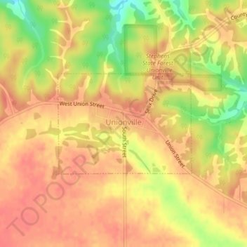
Name: Unionville topographic map, elevation, terrain.

Location: Unionville, Appanoose County, Iowa, United States (40.81263 -92.70553 40.82362 -92.68618)

Average elevation: 284 m

Minimum elevation: 245 m

Maximum elevation: 301 m

Gear up for your next adventure:

🧰Multitool Knife - Compact and versatile tool for outdoor use
🥾Approach Boots - Comfortable boots for hiking and climbing approaches
🧥Ultralight Puffy Jacket - Maximum warmth that packs down to the size of an orange
🥾Lightweight Hiking Boots - Boots for comfort and mobility on long hikes
🚑Survival Whistle - Signal for help across long distances in mountains

As an Amazon Associate, this site earns from qualifying purchases at no extra cost to you.