Geolocate

Uchiwa topographic map

Click on the map to display elevation.

About this map

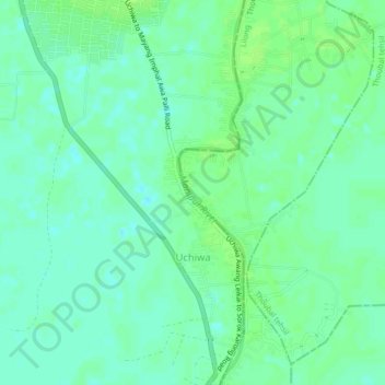
Name: Uchiwa topographic map, elevation, terrain.

Location: Uchiwa, Wangoi, Imphal West, Manipur, 795132, India (24.56946 93.88360 24.60695 93.92572)

Average elevation: 771 m

Minimum elevation: 765 m

Maximum elevation: 776 m

Gear up for your next adventure:

🧦Crew Hiking Socks - Comfortable socks for long-distance hikes
💧Hydration Pack - Hands-free hydration system for long hikes
Bushcraft Tarp - Versatile emergency shelter or gear protection
🌬️Windproof Camp Stove - Efficient cooking even on exposed mountain peaks
🧭Orienteering Kit - Tools for map reading and navigation in the wild

As an Amazon Associate, this site earns from qualifying purchases at no extra cost to you.