Geolocate

Bigolino topographic map

Click on the map to display elevation.

About this map

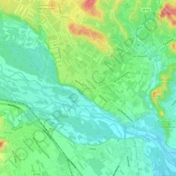
Name: Bigolino topographic map, elevation, terrain.

Location: Bigolino, Valdobbiadene, Treviso, Veneto, 31049, Italy (45.84862 11.99253 45.88862 12.03253)

Average elevation: 168 m

Minimum elevation: 132 m

Maximum elevation: 247 m

Gear up for your next adventure:

🧥Waterproof Hiking Jacket - Protect yourself from rain and wind while hiking
🥾Durable Hiking Shoes - Long-lasting shoes for frequent hiking
🧰Emergency Multi-Tool - Compact multi-tool for outdoor survival
🥾Lightweight Hiking Shoes - Comfortable shoes for day hikes
🧊Insulated Water Bottle - Keeps drinks cold in summer and prevents freezing in winter

As an Amazon Associate, this site earns from qualifying purchases at no extra cost to you.