Geolocate

A Insua topographic map

Click on the map to display elevation.

About this map

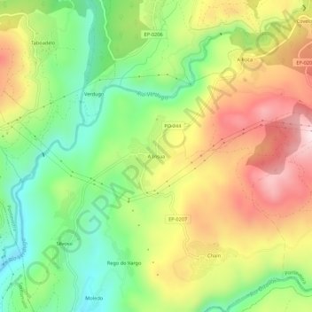
Name: A Insua topographic map, elevation, terrain.

Location: A Insua, Ponte Caldelas, Pontevedra, Galicia, 36826, España (42.34329 -8.54865 42.38329 -8.50865)

Average elevation: 240 m

Minimum elevation: 14 m

Maximum elevation: 517 m

Gear up for your next adventure:

🧢Hiking Sun Hat - Wide-brimmed protection for exposed mountain ridges
🧦Hiking Liner Socks - Thin base layer to prevent friction and blisters
🧥Insulated Jacket - Keep warm in cold outdoor conditions
🧴Bear Spray Holster - Quick-access carry for essential Canadian wilderness safety
🦟Insect Repellent - Keep mosquitoes and black flies away in wooded areas

As an Amazon Associate, this site earns from qualifying purchases at no extra cost to you.