
Thank you for supporting this site ❤️
Make a donation
Make a donation
Gear up for your next adventure:
As an Amazon Associate, this site earns from qualifying purchases at no extra cost to you.
Tambruz topographic map
Click on the map to display elevation.
Thank you for supporting this site ❤️
Make a donation
Make a donation
Gear up for your next adventure:
As an Amazon Associate, this site earns from qualifying purchases at no extra cost to you.
About this map
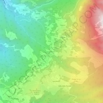
Name: Tambruz topographic map, elevation, terrain.
Location: Tambruz, Tambre, Belluno, Venetien, 32010, Italien (46.11115 12.40517 46.15115 12.44517)
Average elevation: 991 m
Minimum elevation: 528 m
Maximum elevation: 1,689 m
Thank you for supporting this site ❤️
Make a donation
Make a donation
Gear up for your next adventure:
As an Amazon Associate, this site earns from qualifying purchases at no extra cost to you.