Geolocate

Chan da Aldea topographic map

Click on the map to display elevation.

About this map

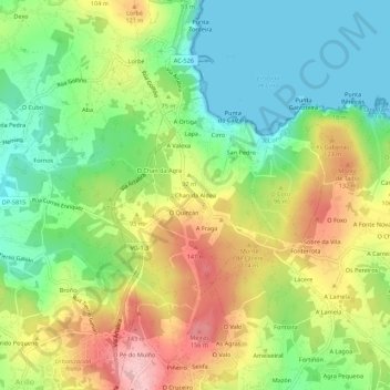
Name: Chan da Aldea topographic map, elevation, terrain.

Location: Chan da Aldea, Veigue, Sada, La Coruña, Galicia, 15169, España (43.35665 -8.31858 43.39665 -8.27858)

Average elevation: 70 m

Minimum elevation: 0 m

Maximum elevation: 166 m

Other topographic maps

Click on a map to view its topography, its elevation and its terrain.

Carnoedo

España > Galicia > La Coruña > Sada

Average elevation: 59 m

Gear up for your next adventure:

💧Reusable Water Bottle - Durable water bottles for hydration on trails
🧣Merino Neck Gaiter - Protects against wind, sun, and cold at high altitudes
Backpacking Tent - Lightweight tent for long-distance hiking trips
🧦Thermal Socks - Warm socks for winter hiking or camping
🧥Thermal Layer - Insulating layer for cold outdoor conditions

As an Amazon Associate, this site earns from qualifying purchases at no extra cost to you.