Geolocate

Navarre topographic map

Click on the map to display elevation.

About this map

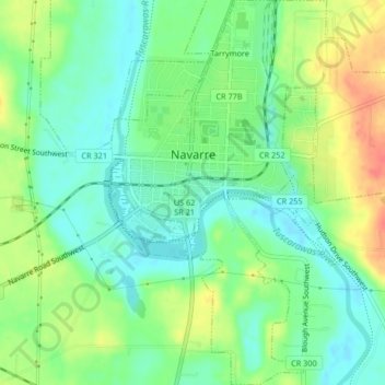
Name: Navarre topographic map, elevation, terrain.

Location: Navarre, Stark County, Ohio, United States (40.70611 -81.53096 40.73743 -81.48974)

Average elevation: 296 m

Minimum elevation: 276 m

Maximum elevation: 329 m

Gear up for your next adventure:

🛶Kayak Dry Bag - Waterproof storage for kayaking adventures
🥾Lightweight Hiking Boots - Boots for comfort and mobility on long hikes
🥾Trail Hiking Shoes - Durable shoes designed for rugged trails
🔦LED Headtorch - Bright and durable light for night activities
Lightweight Backpacking Tent - Compact tent for efficient hiking trips

As an Amazon Associate, this site earns from qualifying purchases at no extra cost to you.