
Thank you for supporting this site ❤️
Make a donation
Make a donation
Gear up for your next adventure:
As an Amazon Associate, this site earns from qualifying purchases at no extra cost to you.
Ormol topographic map
Click on the map to display elevation.
Thank you for supporting this site ❤️
Make a donation
Make a donation
Gear up for your next adventure:
As an Amazon Associate, this site earns from qualifying purchases at no extra cost to you.
About this map
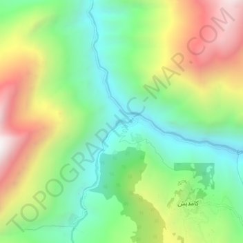
Name: Ormol topographic map, elevation, terrain.
Location: Ormol, Kamdesh, Nuristan Province, Afghanistan (35.40269 71.30646 35.44269 71.34646)
Average elevation: 1,957 m
Minimum elevation: 1,394 m
Maximum elevation: 2,853 m
Thank you for supporting this site ❤️
Make a donation
Make a donation
Gear up for your next adventure:
As an Amazon Associate, this site earns from qualifying purchases at no extra cost to you.