Geolocate

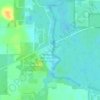
Greenville topographic map

Click on the map to display elevation.

About this map

Name: Greenville topographic map, elevation, terrain.

Location: Greenville, Madison County, Florida, 32331, United States (30.45693 -83.64612 30.47810 -83.62408)

Average elevation: 32 m

Minimum elevation: 24 m

Maximum elevation: 49 m

Other topographic maps

Click on a map to view its topography, its elevation and its terrain.
Gear up for your next adventure:

🧴First Aid Kit - Essential first aid supplies for outdoor emergencies
🧣Merino Neck Gaiter - Protects against wind, sun, and cold at high altitudes
🔋Solar Power Bank - Keep your GPS and devices charged during long outdoor trips
🧥Insulated Jacket - Keep warm in cold outdoor conditions
⛺Family Camping Tent - Spacious tent suitable for family camping trips

As an Amazon Associate, this site earns from qualifying purchases at no extra cost to you.