
Thank you for supporting this site ❤️
Make a donation
Make a donation
Gear up for your next adventure:
As an Amazon Associate, this site earns from qualifying purchases at no extra cost to you.
Chãos topographic map
Click on the map to display elevation.
Thank you for supporting this site ❤️
Make a donation
Make a donation
Gear up for your next adventure:
As an Amazon Associate, this site earns from qualifying purchases at no extra cost to you.
About this map
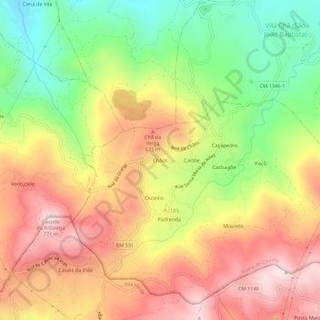
Name: Chãos topographic map, elevation, terrain.
Location: Chãos, Azias, Ponte da Barca, Viana do Castelo, 4980, Portugal (41.75773 -8.37607 41.79773 -8.33607)
Average elevation: 460 m
Minimum elevation: 150 m
Maximum elevation: 752 m
Thank you for supporting this site ❤️
Make a donation
Make a donation
Gear up for your next adventure:
As an Amazon Associate, this site earns from qualifying purchases at no extra cost to you.