Geolocate

Dyea Point topographic map

Click on the map to display elevation.

About this map

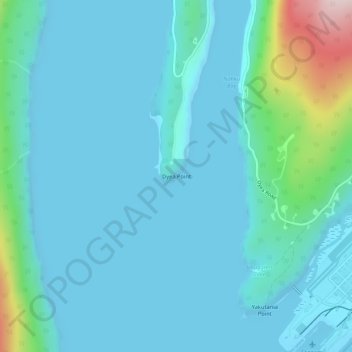
Name: Dyea Point topographic map, elevation, terrain.

Location: Dyea Point, Skagway, Alaska, 99840, United States (59.46301 -135.34672 59.46311 -135.34662)

Average elevation: 49 m

Minimum elevation: 0 m

Maximum elevation: 371 m

Gear up for your next adventure:

❄️Traction Ice Cleats - Slip-on spikes for icy trails and winter hiking
🧼Travel Hand Sanitizer - Keep hands clean when water is scarce
🥾Lightweight Hiking Shoes - Comfortable shoes for day hikes
🥾Lightweight Hiking Boots - Boots for comfort and mobility on long hikes
Bushcraft Tarp - Versatile emergency shelter or gear protection

As an Amazon Associate, this site earns from qualifying purchases at no extra cost to you.