Geolocate

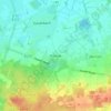
Werpeloh topographic map

Click on the map to display elevation.

About this map

Name: Werpeloh topographic map, elevation, terrain.

Location: Werpeloh, Samtgemeinde Sögel, Landkreis Emsland, Nedersaksen, Duitsland (52.85251 7.41621 52.92959 7.55081)

Average elevation: 35 m

Minimum elevation: 10 m

Maximum elevation: 72 m

Other topographic maps

Click on a map to view its topography, its elevation and its terrain.

Gleesen

Duitsland > Nedersaksen > Landkreis Emsland

Average elevation: 29 m

Neusustrum

Duitsland > Nedersaksen > Landkreis Emsland

Average elevation: 11 m

Hesselte

Duitsland > Nedersaksen > Landkreis Emsland > Emsbüren

Average elevation: 31 m

Sprakel

Duitsland > Nedersaksen > Landkreis Emsland > Stavern

Average elevation: 39 m

Sand

Duitsland > Nedersaksen > Landkreis Emsland > Oberlangen

Average elevation: 10 m

Haar

Duitsland > Nedersaksen > Landkreis Emsland > Haren (Ems)

Average elevation: 15 m

Gear up for your next adventure:

🧴Outdoor Sunscreen - High SPF protection for high-altitude UV exposure
🛁Quick-Dry Microfiber Towel - Space-saving towel that dries rapidly on the move
🥾Trail Hiking Socks - Comfortable socks to prevent blisters and fatigue
👟Trail Running Shoes - Agile footwear for fast-paced topographic exploration
🧢Hiking Hat - Sun-protective and breathable hats for long treks

As an Amazon Associate, this site earns from qualifying purchases at no extra cost to you.