Geolocate

Whitman Lake topographic map

Click on the map to display elevation.

About this map

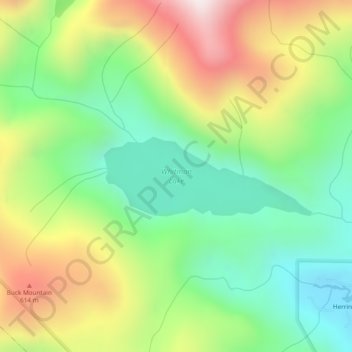
Name: Whitman Lake topographic map, elevation, terrain.

Location: Whitman Lake, Ketchikan Gateway, Alaska, United States (55.33292 -131.56000 55.33902 -131.53188)

Average elevation: 313 m

Minimum elevation: 0 m

Maximum elevation: 785 m

Other topographic maps

Click on a map to view its topography, its elevation and its terrain.

Juno Mountain

United States > Alaska > Ketchikan Gateway

Average elevation: 438 m

Saxman

United States > Alaska > Ketchikan Gateway

Average elevation: 139 m

Herring Cove

United States > Alaska > Ketchikan Gateway

Average elevation: 157 m

Mud Bay

United States > Alaska > Ketchikan Gateway

Average elevation: 115 m

Gear up for your next adventure:

🔥Emergency Fire Starter - Reliable ignition source for all weather conditions
🏃Hydration Running Vest - Carry water and maps close to your body for speed
🥤Collapsible Travel Cup - Saves space and weight in your mess kit
🦶Anti-Blister Balm - Prevents friction and hotspots during long ascents
🥫Freeze-Dried Meals - Lightweight, high-calorie nutrition for multi-day treks

As an Amazon Associate, this site earns from qualifying purchases at no extra cost to you.