Geolocate

Morteau topographic map

Click on the map to display elevation.

About this map
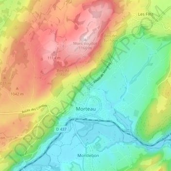
Name: Morteau topographic map, elevation, terrain.

Location: Morteau, Pontarlier, Doubs, Bourgogne – Franche-Comté, Metropolitan France, 25500, France (47.03972 6.55059 47.08845 6.62760)

Average elevation: 911 m

Minimum elevation: 744 m

Maximum elevation: 1,159 m

Other topographic maps

Click on a map to view its topography, its elevation and its terrain.
Gear up for your next adventure:

🧦Outdoor Socks - Durable socks designed for hiking and outdoor sports
💧Hydration Bladder - Hands-free hydration solution for long treks
🔦LED Headtorch - Bright and durable light for night activities
⛺Camping Essentials - All-in-one gear for a comfortable camping trip
🧭Orienteering Kit - Tools for map reading and navigation in the wild

As an Amazon Associate, this site earns from qualifying purchases at no extra cost to you.