Geolocate

Duzduzan topographic map

Click on the map to display elevation.

Duzduzan

Duzduzan is located in the mountains of Arasbaran in north-western Iran on the highway between Ardabil and Tabriz. Although not on the river it is within the drainage basin of the Aji Chay. Because of its high elevation it has a climate that is generally cold and rainy. The city is 15 km by road east of the village of Kurdkandi and 32 km by road east of Bostanabad. Duzduzan is 37 km by road west of the city of Sarab, the county seat.

Wikipedia (CC-BY-SA 3.0)

About this map

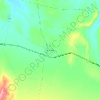
Name: Duzduzan topographic map, elevation, terrain.

Location: Duzduzan, دهستان شربیان, بخش مهربان, Sarab County, East Azerbaijan Province, Iran (37.90898 47.07979 37.98898 47.15979)

Average elevation: 1,672 m

Minimum elevation: 1,624 m

Maximum elevation: 1,786 m

Gear up for your next adventure:

🗺️Topographic Maps - Detailed maps to explore trails, mountains, and wilderness areas
🔋Emergency Crank Radio - Weather alerts and power without needing batteries
🏃Hydration Running Vest - Carry water and maps close to your body for speed
🔭Compact Monocular - One-handed bird watching and trail spotting
🏕️Camping Hammock - Integrated protection for sleeping between trees

As an Amazon Associate, this site earns from qualifying purchases at no extra cost to you.