Geolocate

Tacurong topographic map

Click on the map to display elevation.

About this map

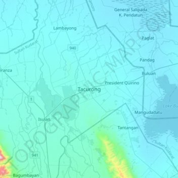
Name: Tacurong topographic map, elevation, terrain.

Location: Tacurong, Sultan Kudarat, Soccsksargen, 9800, Philippines (6.52844 124.51866 6.84844 124.83866)

Average elevation: 52 m

Minimum elevation: 5 m

Maximum elevation: 1,065 m

Gear up for your next adventure:

💡LED Camping Lantern - Illuminate your campsite with long-lasting lanterns
🔦LED Flashlight - Powerful and long-lasting flashlight for camping and emergencies
🛶Waterproof Dry Bags - Keep electronics and clothes dry during river crossings
Camping Tent - Weather-resistant tents suitable for 2 to 6 people
Backpacking Tent - Lightweight tent for long-distance hiking trips

As an Amazon Associate, this site earns from qualifying purchases at no extra cost to you.