
Vinicunca topographic map
Click on the map to display elevation.
Vinicunca
Vinicunca, or Winikunka, also called Montaña de Siete Colores (literally: Mountain of seven colors), Montaña de Colores (Mountain of colors) or Montaña Arcoíris (Rainbow Mountain), is a mountain in the Andes of Peru with an altitude of 5,036 metres (16,522 ft) above sea level. It is located on the road to the Ausangate mountain, in the Cusco region, between Cusipata District, province of Quispicanchi, and Pitumarca District, province of Canchis.
About this map
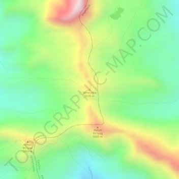
Name: Vinicunca topographic map, elevation, terrain.
Average elevation: 4,874 m
Minimum elevation: 4,636 m
Maximum elevation: 5,214 m