Geolocate

Catanzaro topographic map

Click on the map to display elevation.

About this map

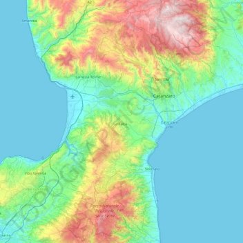
Name: Catanzaro topographic map, elevation, terrain.

Location: Catanzaro, Calabria, Italy (38.46334 16.09549 39.19424 16.92060)

Average elevation: 353 m

Minimum elevation: -1 m

Maximum elevation: 1,756 m

Other topographic maps

Click on a map to view its topography, its elevation and its terrain.

Amendolèa

Italy > Calabria > Reggio Calabria

Average elevation: 320 m

Acconia

Italy > Calabria > Catanzaro

Average elevation: 49 m

Gear up for your next adventure:

🧭GPS Outdoor Watch - Smart watch for navigation and fitness tracking in nature
🩹Moleskin Blister Pads - Direct protection for painful foot pressure points
👟Leg Gaiters - Keep debris, mud, and snow out of your boots
🧢Outdoor Visor - Breathable visor for sunny hikes
Camping Groundsheet - Protect your tent from moisture and dirt

As an Amazon Associate, this site earns from qualifying purchases at no extra cost to you.