Geolocate

San Francisco topographic map

Click on the map to display elevation.

About this map

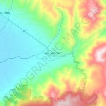
Name: San Francisco topographic map, elevation, terrain.

Location: San Francisco, Putumayo, 861020, Colombia (1.13487 -76.91886 1.21487 -76.83886)

Average elevation: 2,405 m

Minimum elevation: 2,073 m

Maximum elevation: 3,000 m

Gear up for your next adventure:

🧦Crew Hiking Socks - Comfortable socks for long-distance hikes
🦯Trekking Poles - Reduced impact on joints for steep topographic climbs
🧦Hiking Socks - Moisture-wicking and comfortable socks for long hikes
🥾Waterproof Hiking Boots - Essential footwear for rugged terrain and wet Canadian trails
🥽Outdoor Goggles - Protective eyewear for outdoor activities

As an Amazon Associate, this site earns from qualifying purchases at no extra cost to you.