Geolocate

Oliveto Lario topographic map

Click on the map to display elevation.

About this map

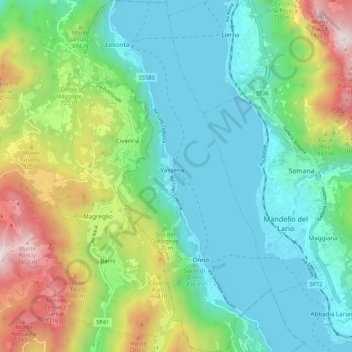
Name: Oliveto Lario topographic map, elevation, terrain.

Location: Oliveto Lario, Lecco, Lombardy, 23865, Italy (45.89198 9.25608 45.96654 9.31480)

Average elevation: 569 m

Minimum elevation: 189 m

Maximum elevation: 1,518 m

Other topographic maps

Click on a map to view its topography, its elevation and its terrain.

Olcio

Italy > Lombardy > Lecco > Mandello del Lario

Average elevation: 413 m

Grigna Settentrionale

Italy > Lombardy > Lecco > Pasturo

Average elevation: 1,875 m

Gear up for your next adventure:

🥽Outdoor Goggles - Protective eyewear for outdoor activities
🧦Merino Wool Socks - Moisture-wicking comfort for long-distance hiking
🥾Trail Hiking Shoes - Durable shoes designed for rugged trails
🥾Trail Hiking Boots - Supportive boots for rough trails
🧥Waterproof Pants - Keep dry during rainy hiking conditions

As an Amazon Associate, this site earns from qualifying purchases at no extra cost to you.