Geolocate

Lower Taobat topographic map

Click on the map to display elevation.

About this map

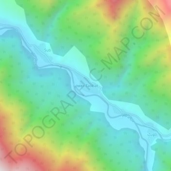
Name: Lower Taobat topographic map, elevation, terrain.

Location: Lower Taobat, Neelam Valley District, Azad Kashmir, Pakistan (34.71772 74.67144 34.75772 74.71144)

Average elevation: 2,597 m

Minimum elevation: 2,228 m

Maximum elevation: 3,506 m

Other topographic maps

Click on a map to view its topography, its elevation and its terrain.

Kotli District

Pakistan > Azad Kashmir

Average elevation: 898 m

Muzaffarabad

Pakistan > Azad Kashmir

Average elevation: 793 m

Tehsil Dadyal

Pakistan > Azad Kashmir

Average elevation: 474 m

Muzaffarabad District

Pakistan > Azad Kashmir

Average elevation: 1,826 m

Mirpur District

Pakistan > Azad Kashmir

Average elevation: 511 m

Shounter Lake

Pakistan > Azad Kashmir > Sharda Tehsil

Average elevation: 3,357 m

Betar Nala

Pakistan > Azad Kashmir > Haveli District

Average elevation: 1,967 m

Bagh Tehsil

Pakistan > Azad Kashmir

Average elevation: 1,981 m

Leepa

Pakistan > Azad Kashmir

Average elevation: 2,217 m

Jagran

Pakistan > Azad Kashmir > Kundal Shahi

Average elevation: 3,283 m

Gear up for your next adventure:

💡LED Camping Lantern - Illuminate your campsite with long-lasting lanterns
🥾Approach Boots - Comfortable boots for hiking and climbing approaches
🦟Insect Repellent - Keep mosquitoes and black flies away in wooded areas
🦶Anti-Blister Balm - Prevents friction and hotspots during long ascents
🥾Light Hiking Boots - Lightweight and comfortable boots for day hikes

As an Amazon Associate, this site earns from qualifying purchases at no extra cost to you.