Geolocate

Strawberry Reservoir topographic map

Click on the map to display elevation.

About this map

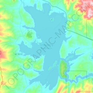
Name: Strawberry Reservoir topographic map, elevation, terrain.

Location: Strawberry Reservoir, Wasatch County, Utah, United States (40.11220 -111.19389 40.23656 -111.02168)

Average elevation: 2,392 m

Minimum elevation: 2,308 m

Maximum elevation: 2,803 m

Other topographic maps

Click on a map to view its topography, its elevation and its terrain.

Soldier Summit

United States > Utah > Wasatch County

Average elevation: 2,323 m

Gear up for your next adventure:

🥾Mountaineering Boots - Supportive boots for climbing and high-altitude hiking
🔦LED Flashlight - Powerful and long-lasting flashlight for camping and emergencies
🧥Softshell Jacket - Windproof and breathable jacket for hiking
🦶Hiking Shoe Insoles - Added support for high arches and long days on feet
🪜Heavy Duty Carabiners - Multi-use clips for securing gear to your backpack

As an Amazon Associate, this site earns from qualifying purchases at no extra cost to you.