Geolocate

Limagne topographic map

Click on the map to display elevation.

About this map
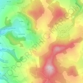
Name: Limagne topographic map, elevation, terrain.

Location: Limagne, Siaugues-Sainte-Marie, Brioude, Haute-Loire, Auvergne-Rhône-Alpes, France métropolitaine, 43300, France (45.04142 3.62428 45.08142 3.66428)

Average elevation: 1,082 m

Minimum elevation: 876 m

Maximum elevation: 1,279 m

Other topographic maps

Click on a map to view its topography, its elevation and its terrain.

Gear up for your next adventure:

🧦Hiking Liner Socks - Thin base layer to prevent friction and blisters
🔭Outdoor Binoculars - Lightweight binoculars for birdwatching and hiking
🎒Fully Waterproof Backpack - Total protection for photography gear and electronics
🚲MTB Frame Bag - Carry tools and maps directly on your bicycle frame
🚲Bike Repair Kit - Essential tools for on-trail mechanical issues

As an Amazon Associate, this site earns from qualifying purchases at no extra cost to you.