Geolocate

Lost Hill topographic map

Click on the map to display elevation.

About this map

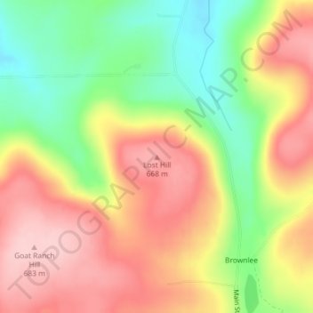
Name: Lost Hill topographic map, elevation, terrain.

Location: Lost Hill, Tioga County, Pennsylvania, United States (41.67669 -77.26669 41.67679 -77.26659)

Average elevation: 598 m

Minimum elevation: 497 m

Maximum elevation: 687 m

Other topographic maps

Click on a map to view its topography, its elevation and its terrain.

Elkland

United States > Pennsylvania > Tioga County

Average elevation: 403 m

Gear up for your next adventure:

🧭GPS Outdoor Watch - Smart watch for navigation and fitness tracking in nature
🔪Outdoor Multitool - Versatile tool for repairs and food prep in the wild
🥾Mountain Hiking Boots - High-traction boots for rocky terrain
Camping Essentials - All-in-one gear for a comfortable camping trip
🧥Thermal Layer - Insulating layer for cold outdoor conditions

As an Amazon Associate, this site earns from qualifying purchases at no extra cost to you.