Geolocate

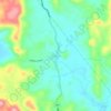
Panamaon topographic map

Click on the map to display elevation.

About this map

Name: Panamaon topographic map, elevation, terrain.

Location: Panamaon, Loreto, Dinagat Islands, Caraga, Philippines (10.39863 125.56567 10.47158 125.67566)

Average elevation: 85 m

Minimum elevation: -2 m

Maximum elevation: 880 m

Other topographic maps

Click on a map to view its topography, its elevation and its terrain.
Mabini

Philippines > Dinagat Islands > Loreto

Average elevation: 53 m

Gear up for your next adventure:

🧊Portable Cooler - Keep food and drinks cold during outdoor adventures
🥾Mountain Trail Shoes - High-traction shoes for mountain trails
🛶Canoe Life Vest - Safety vest for water sports
🛶Kayak Dry Bag - Waterproof storage for kayaking adventures
🛶Waterproof Dry Bags - Keep electronics and clothes dry during river crossings

As an Amazon Associate, this site earns from qualifying purchases at no extra cost to you.