Geolocate

Torrelles topographic map

Click on the map to display elevation.

About this map

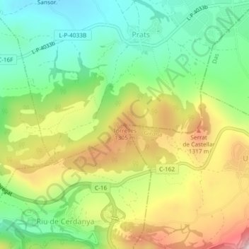
Name: Torrelles topographic map, elevation, terrain.

Location: Torrelles, Prats i Sansor, Cerdaña, Lérida, Cataluña, España (42.35564 1.83478 42.35574 1.83488)

Average elevation: 1,198 m

Minimum elevation: 1,060 m

Maximum elevation: 1,396 m

Gear up for your next adventure:

🛌Down Sleeping Bag - Superior warmth-to-weight ratio for cold nights
🧢Hiking Hat - Sun-protective and breathable hats for long treks
🌡️Emergency Mylar Blankets - Compact thermal protection for unexpected nights outdoors
🧴Bear Spray Holster - Quick-access carry for essential Canadian wilderness safety
🔥Camping Stove - Portable stoves to cook outdoors with ease

As an Amazon Associate, this site earns from qualifying purchases at no extra cost to you.