Geolocate

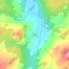
Saint-Martin topographic map

Click on the map to display elevation.

About this map

Name: Saint-Martin topographic map, elevation, terrain.

Location: Saint-Martin, Beauce-Sartigan, Chaudière-Appalaches, Quebec, G0M 1B0, Canada (45.88269 -70.73176 46.04739 -70.56054)

Average elevation: 341 m

Minimum elevation: 196 m

Maximum elevation: 484 m

Other topographic maps

Click on a map to view its topography, its elevation and its terrain.

Lac Douville

Canada > Quebec > Beauce-Sartigan > Saint-Georges

Average elevation: 320 m

Gear up for your next adventure:

🧭GPS Tracker - Track your location in remote areas safely
🥾Lightweight Hiking Shoes - Comfortable shoes for day hikes
🧣Merino Neck Gaiter - Protects against wind, sun, and cold at high altitudes
🧰Multitool Knife - Compact and versatile tool for outdoor use
🎒Fully Waterproof Backpack - Total protection for photography gear and electronics

As an Amazon Associate, this site earns from qualifying purchases at no extra cost to you.