Geolocate

Loñgos topographic map

Click on the map to display elevation.

About this map

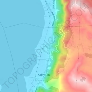
Name: Loñgos topographic map, elevation, terrain.

Location: Loñgos, Kalayaan, Laguna, Calabarzon, 4015, Philippines (14.32014 121.46089 14.36014 121.50089)

Average elevation: 125 m

Minimum elevation: -2 m

Maximum elevation: 420 m

Gear up for your next adventure:

🪜Heavy Duty Carabiners - Multi-use clips for securing gear to your backpack
🥤Collapsible Travel Cup - Saves space and weight in your mess kit
🧢Beanie Hat - Keep your head warm in cold weather
🧊Portable Cooler - Keep food and drinks cold during outdoor adventures
🚲Handlebar Phone Mount - View topographic-map.com live while cycling

As an Amazon Associate, this site earns from qualifying purchases at no extra cost to you.