Geolocate

Dam-an topographic map

Click on the map to display elevation.

About this map

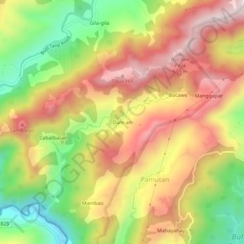
Name: Dam-an topographic map, elevation, terrain.

Location: Dam-an, Pamutan, Cebu City, Central Visayas, Philippines (10.32283 123.81003 10.36283 123.85003)

Average elevation: 397 m

Minimum elevation: 69 m

Maximum elevation: 686 m

Gear up for your next adventure:

🎒Hiking Backpack - Lightweight and ergonomic backpacks for day hikes or multi-day treks
🔋Lithium AA Batteries - Long-lasting power that performs in extreme cold
🥾Hiking Leggings - Comfortable leggings for outdoor activities
🧣Merino Neck Gaiter - Protects against wind, sun, and cold at high altitudes
🕶️Polarized Sunglasses - Reduces glare from snow and water at high elevations

As an Amazon Associate, this site earns from qualifying purchases at no extra cost to you.