Geolocate

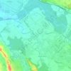
Nabas topographic map

Click on the map to display elevation.

About this map

Name: Nabas topographic map, elevation, terrain.

Location: Nabas, Oloron-Sainte-Marie, Pyrénées-Atlantiques, Nouvelle-Aquitaine, Metropolitan France, 64190, France (43.31495 -0.91077 43.34793 -0.87068)

Average elevation: 121 m

Minimum elevation: 76 m

Maximum elevation: 210 m

Other topographic maps

Click on a map to view its topography, its elevation and its terrain.
Gear up for your next adventure:

🛏️Camping Sleeping Mat - Comfortable mats for sleeping outdoors
🔥Emergency Fire Starter - Reliable ignition source for all weather conditions
🌡️Emergency Mylar Blankets - Compact thermal protection for unexpected nights outdoors
🔋Solar Power Bank - Keep your GPS and devices charged during long outdoor trips
🦟Insect Repellent - Keep mosquitoes and black flies away in wooded areas

As an Amazon Associate, this site earns from qualifying purchases at no extra cost to you.