Geolocate

Stramare topographic map

Click on the map to display elevation.

About this map

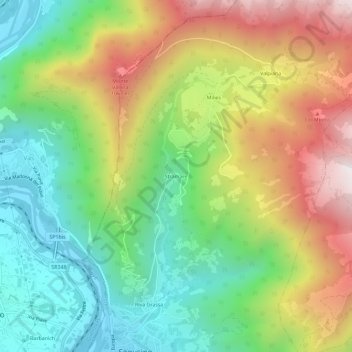
Name: Stramare topographic map, elevation, terrain.

Location: Stramare, Segusino, Treviso, Veneto, 32038, Italy (45.91666 11.94053 45.95666 11.98053)

Average elevation: 618 m

Minimum elevation: 174 m

Maximum elevation: 1,266 m

Gear up for your next adventure:

💡Portable Camping Lamp - Rechargeable lamp for campsite lighting
🕯️Camping Lantern - Illuminates your entire campsite with high-efficiency LEDs
🥾Approach Shoes - Shoes designed for climbing approaches and rugged trails
🧴Waterproofing Spray - Restore the DWR coating on jackets and tents
🧥Softshell Jacket - Windproof and breathable jacket for hiking

As an Amazon Associate, this site earns from qualifying purchases at no extra cost to you.