
городской округ Шатура topographic map
Interactive map
Click on the map to display elevation.
About this map
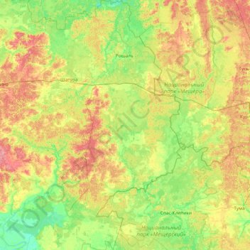
Name: городской округ Шатура topographic map, elevation, terrain.
Average elevation: 126 m
Minimum elevation: 100 m
Maximum elevation: 177 m
Other topographic maps
Click on a map to view its topography, its elevation and its terrain.
Río Oká
Río Oká, городской округ Луховицы, Óblast de Moscú, Distrito federal Central, 390536, Rusia
Average elevation: 167 m