Geolocate

Thompson Falls topographic map

Click on the map to display elevation.

Thompson Falls

Thompson Falls is located in the Clark Fork Valley at an elevation of 2,419 feet (737 m). The Clark Fork River flows on the southern side of town. It is next to the Cabinet Mountains.

Wikipedia (CC-BY-SA 3.0)

About this map

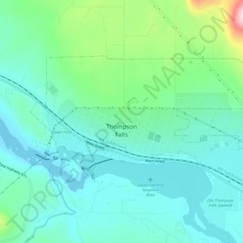
Name: Thompson Falls topographic map, elevation, terrain.

Location: Thompson Falls, Sanders County, Montana, 59873, United States (47.58906 -115.36343 47.60768 -115.31243)

Average elevation: 782 m

Minimum elevation: 713 m

Maximum elevation: 1,022 m

Gear up for your next adventure:

🕶️Polarized Sunglasses - Reduces glare from snow and water at high elevations
🥾Light Trekking Boots - Supportive boots for multi-day treks
🥾Approach Shoes - Shoes designed for climbing approaches and rugged trails
🧥Insulated Jacket - Keep warm in cold outdoor conditions
🛶Waterproof Dry Bags - Keep electronics and clothes dry during river crossings

As an Amazon Associate, this site earns from qualifying purchases at no extra cost to you.