
Sangi masha topographic map
Interactive map
Click on the map to display elevation.
About this map
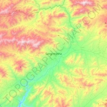
Name: Sangi masha topographic map, elevation, terrain.
Location: Sangi masha, ولایت جاغوری, Ghazni, Afghanistan (32.97979 67.28085 33.29979 67.60085)
Average elevation: 2,846 m
Minimum elevation: 2,035 m
Maximum elevation: 4,010 m