Geolocate

Albaretto topographic map

Click on the map to display elevation.

About this map
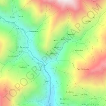
Name: Albaretto topographic map, elevation, terrain.

Location: Albaretto, Ingria, Torino, Piemonte, 10085, Italia (45.44594 7.56802 45.48594 7.60802)

Average elevation: 1,134 m

Minimum elevation: 555 m

Maximum elevation: 1,931 m

Gear up for your next adventure:

🥾Mountain Hiking Boots - High-traction boots for rocky terrain
🧴Outdoor Sunscreen - High SPF protection for high-altitude UV exposure
🕶️Polarized Sunglasses - Reduces glare from snow and water at high elevations
🧴Waterproofing Spray - Restore the DWR coating on jackets and tents
🚲Bike Repair Kit - Essential tools for on-trail mechanical issues

As an Amazon Associate, this site earns from qualifying purchases at no extra cost to you.