
Mauri topographic map
Click on the map to display elevation.
About this map
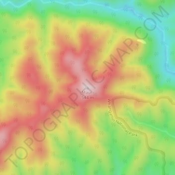
Name: Mauri topographic map, elevation, terrain.
Location: Mauri, Whanganui District, Manawatū-Whanganui, New Zealand (-39.42433 174.98991 -39.42423 174.99001)
Average elevation: 310 m
Minimum elevation: 83 m
Maximum elevation: 528 m
Other topographic maps
Click on a map to view its topography, its elevation and its terrain.
Lake Wiritoa
New Zealand > Manawatu-Whanganui > Whanganui District > Whanganui > Pauri Village
Average elevation: 50 m
Kaitoke Lake
New Zealand > Manawatu-Whanganui > Whanganui District > Whanganui
Average elevation: 41 m
Lake Pauri
New Zealand > Manawatu-Whanganui > Whanganui District > Whanganui > Pauri Village
Average elevation: 57 m